The Urban Coroner
Photography By Sugarbomb
OKEELANTA
The early 20th century Everglades town that couldn't stand a chance against the South Florida swamp.

Northbound on US-27 | Photo © 2017 Sugarbomb
After a morning of researching the history of Pahokee, the hurricane of 1928, and accidentally stumbling across pictures of an abandoned jail in Belle Glade, my curiosity was piqued and before noon I was dressed and out the door with my sights set on the swamp.
The morbid and tragic story of the 1928 hurricane was still fresh in my mind when I noticed how high the waters of the swamp had crept over their banks after all of the rain and upstate flooding in the previous two weeks. The water was definitely level with the road and barely a foot from the edge of the small shoulder. It made me uneasy to know that this road looked to be one good rainstorm away from being under water.

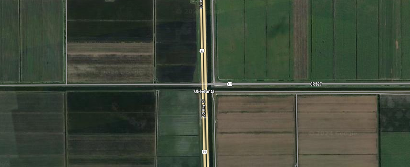
Google Maps screenshot of Okeelanta.
I sped along US-27, no cops to care about my speed this far out, blasting my music as loud as I wanted and singing along to Lana Del Rey’s “Florida Kilos”. I had no particular destination in mind today, just a vague list of things I wanted to check out and photograph, and no one to please but myself.
I glanced down at the map on my phone and did a double take and quickly took a screenshot when a familiar name caught my eye; Okeelanta. I had read briefly about Okeelanta earlier that morning while researching the hurricane of 1928 and the resulting devastation.
Around 1905-1928 the entire Glades region was promoted worldwide as exciting and mostly uncharted territory with the newest, cheapest, and most profitable farmland ever discovered. Settling in the Everglades was a new frontier, a unique challenge – for perspective, the "Wild West" was long-settled when the towns in the Everglades were just being conceived.
Okeelanta was one of the earliest settlements that was literally cut out of the sawgrass marshes south of Lake Okeechobee. The town’s name is a portmanteau of Lake Okeechobee and the Atlantic Ocean.

Historic Palm Beach Farms Company Lands map from 1910 showing "edge of Everglades" | Photo source: Lawrence E. Will Museum of the Glades
The city was founded by a man named Thomas Elmer Will, a former college professor, college president, and secretary of the American Forestry Association. In early 1913, he purchased almost 900 acres of land south of Lake Okeechobee and adjacent to another 120 acres of land he had previously purchased. Later that year, Will launched the planned community of Okeelanta on what is now where the Bolles Canal meets the North New River Canal, laying out small plots to sell to settlers. His son Lawrence was one of the first five settlers to move to the area.
Although the settlers had difficulty farming the soil muck, they eventually managed by varying their crops of beans, potatoes, cabbage, and lettuce. Thomas Will himself joined the group of settlers in late 1914. Supplies were shipped to the community by boat up the New River from Fort Lauderdale, almost sixty miles away. In early 1915, a store was built after Will offered the store owner a lot free of charge. New settlers arrived during 1915. In 1916, the Palm Beach County School Board built a one-room schoolhouse on a lot donated by Thomas Will.

The home of Thomas E. Will, built on the North New River Canal in Okeelanta, taken September 9, 1916 | Photo source: FIU Digital Collection
Okeelanta was home to 110 families by 1917, as well as a hotel, town hall, lumberyard, blacksmith, and barber. Will and other residents organized for the construction of a road from West Palm Beach to Fort Myers through Okeelanta. Although the road was built, it bypassed Okeelanta and ran along the south shore of Lake Okeechobee four miles north. Nevertheless, a dirt road was constructed along the spoil bank of the Bolles Canal connecting Okeelanta with the cross-state highway at Six Mile Bridge, just southeast of Belle Glade.
Despite bad soil, floods, fires, freezes, wild animals, and mosquitoes, Okeelanta did become the largest community in the area, if only briefly. By 1920 the town had grown to 200 residents. However, that year saw particularly devastating flooding, which caused a suspension of agricultural operations.
During the early 1920s the water table fluctuated greatly, sinking to levels ideal for farming, but too low for shipping, or to levels too high for farming yet ideal for shipping. Muck fires also ravaged the land when the water table was especially low.

An automobile being transported by ferry on the New River Canal in Okeelanta, Florida taken in 1920 | Photo Source: State Library and Archives of Florida
In 1922, Will left Okeelanta for Fort Lauderdale on what he believed would be a temporary basis. By 1925, a visitor described Okeelanta to be "soggy and deserted," with the north side of the Bolles Canal dominated by sawgrass and boggy ground in front of the old hotel. The final nail in the coffin of the town of Okeelanta came in 1928 when the hurricane decimated the surrounding area and essentially wiped it off the map. Figuratively speaking, of course, because for some reason the name of the town still appears on my Google Maps almost a century later.
Near where the ill-fated early 20th century town once stood is now the location of the Okeelanta Mill, one of two sugar mills owned and operated by the Florida Crystals company. This sugar mill is one of the largest specialty sugar facilities in the world, using exclusively locally grown sugarcane and making organic and raw cane sugar products sold under the Florida Crystals brand.

Florida Crystals sign on US-27 near where Okeelanta stood a century ago | Photo © 2017 Sugarbomb
The Lawrence E. Will Museum located in the nearby city of Belle Glade is named after the son of Okeelanta pioneer Thomas E. Will. Located less than 10 miles northeast of the area where Okeelanta once was, the museum explores the local history of the area with an archive collection that dates back thousands of years to the earliest known settlers of the land around Lake Okeechobee.
I looked at the area around me as I drove, trying to spot some sign of the town that once was, but other than two sparsely placed structures among the sugarcane and tall grass on the side of the road, there's no sign of the town that once existed there other than a name on a map app.